1. Copy and paste your data
Two ways to use AutoGeoMapper
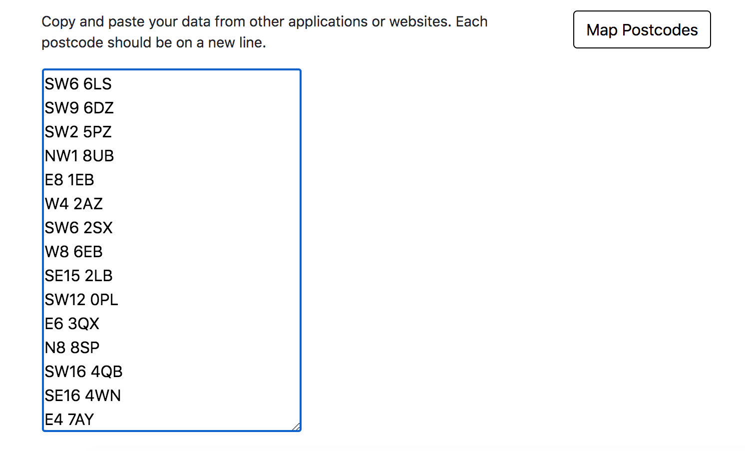
List of Postcodes
Copy and paste a list of postcodes into the AutoGeoMapper
Datasets with names
Download a template with ward or local authority names.
Change the value column for your data.
Copy and paste the dataset into the AutoGeoMapper.
Your data is safe.
Even though AutoGeoMapper is a web app, the data you insert will be processed only by the web browser. No server-side operations or storages are performed, no one will see, touch or copy your data!
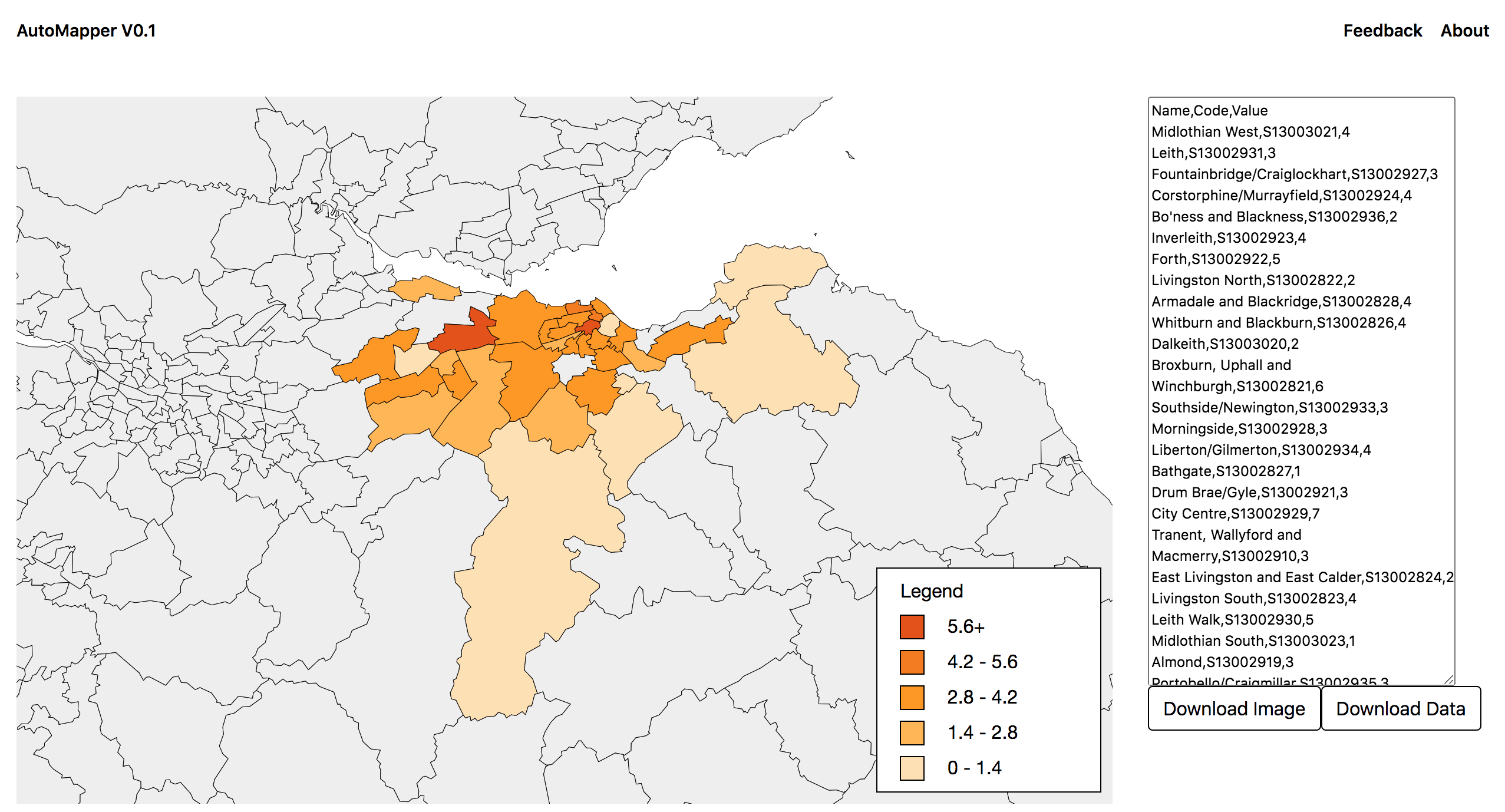
2. Explore your data
View your specially generated map. Understand how your data varies across UK Local Authority or Ward Boundaries. Spot patterns in your data by comparing colors.
3. Download your Maps
Download your map or aggregated dataset to include in reports